

Advanced Drone Services for Atmospheric Science & Operational Meteorology
Menapia provides world-class drone services that capture the atmosphere in exceptional detail, powering better science, forecasting, and climate-smart decisions.

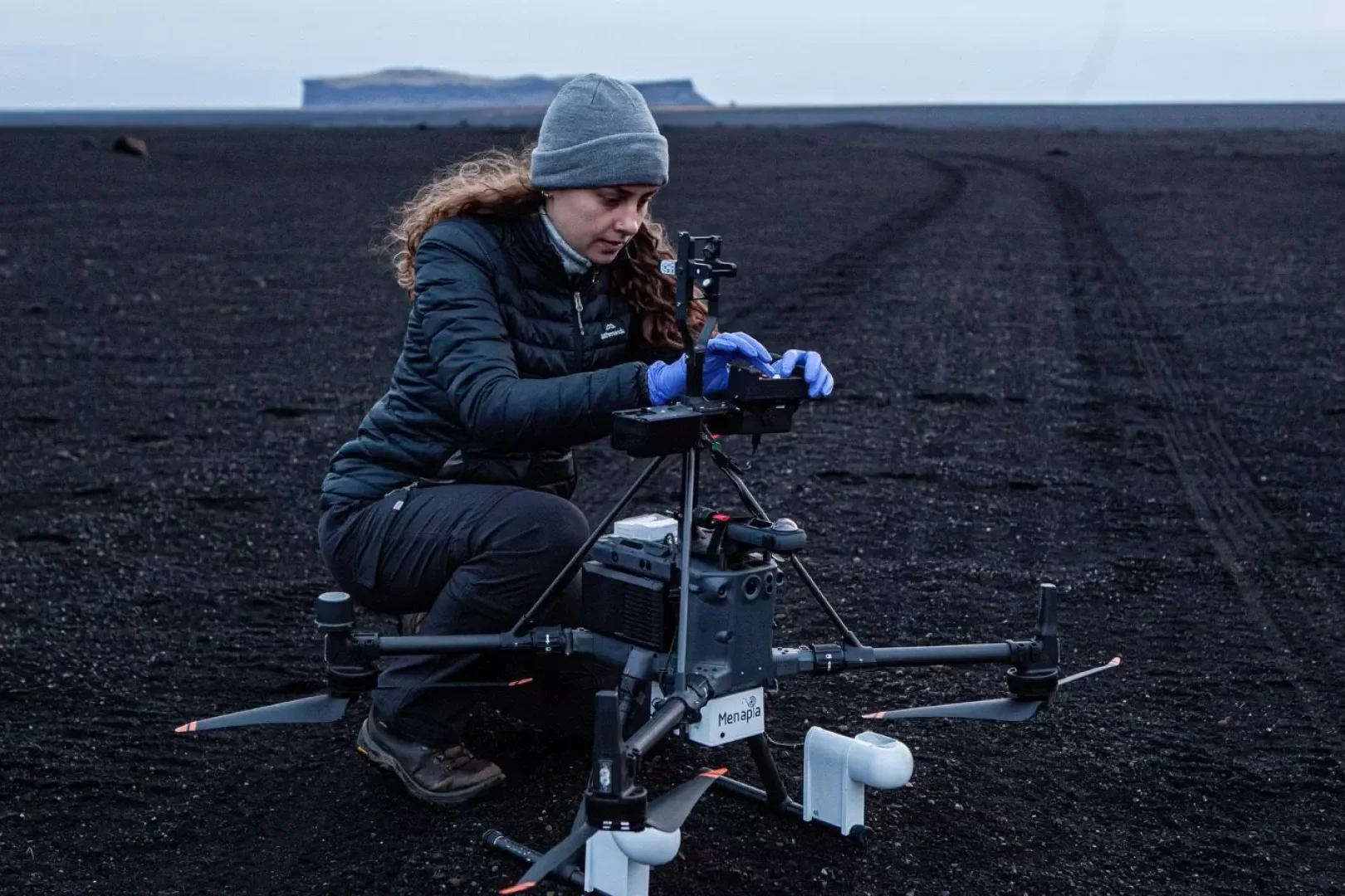
MetSensor — Research-Grade Core Payload
Developed through five years of iterative engineering and field validation, MetSensor is Menapia’s primary meteorological suite. It meets—or for key parameters exceeds—international performance objectives, delivering research-grade measurements of temperature, humidity and pressure. The module is engineered for operational resilience, and integrates robust environmental protection and reliability safeguards to withstand the demanding, continuous flight regimes of operational meteorology.
The latest revision is over 30 % lighter and markedly more compact, leaving ample payload margin on even the smallest UAVs we operate while retaining full five-point, UKAS/NIST-traceable calibration. MetSensor can fly as a dedicated WxUAS package or alongside additional instruments, ensuring every sortie produces rigorously validated thermodynamic data for science and operations.
Advanced Sensor R&D
Our multidisciplinary team designs, prototypes, and qualifies specialised atmospheric sensors for client projects and internal programmes alike. Backed by strong research partnerships and extensive flight experience, we deliver bespoke airborne sensor solutions and have the expertise and facilities to put every sensor through rigorous calibration–validation before deployment.


Authorised wxUAS Networks
The MetSprite Platform addresses the intricate challenges of atmospheric robotics to enable safe, scalable wxUAS networks within national airspace. Our expertise in aerospace allows you to receive the data you need — leveraging our regulatory permissions for 24/7 high-altitude operations.

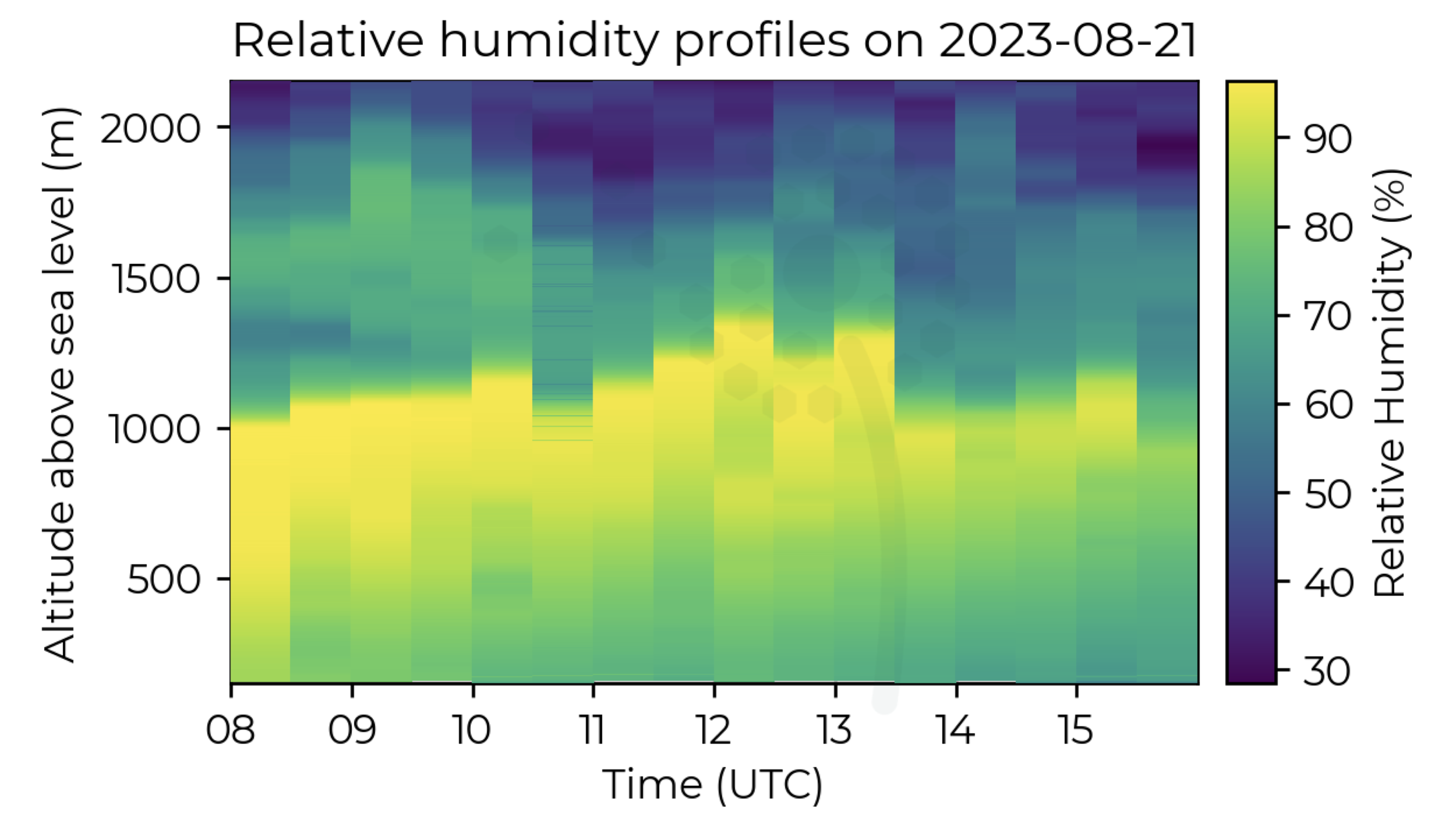
Real-world Examples from the MetSprite Platform
Atmospheric data can be delivered in many formats including netCDF, BUFR, TEMP, WMO, and API integrations. Real-time visualisations give quick insights to end users.


Your Path to Enhanced Atmospheric Profiles
We'll use our unique expertise and custom geospatial tools to build a feasibility report for your observation requirements. We then provide you with an initial quotation.
Feasibility Report & Quotation