
OTTER: building drone-borne lasers to measure turbulence
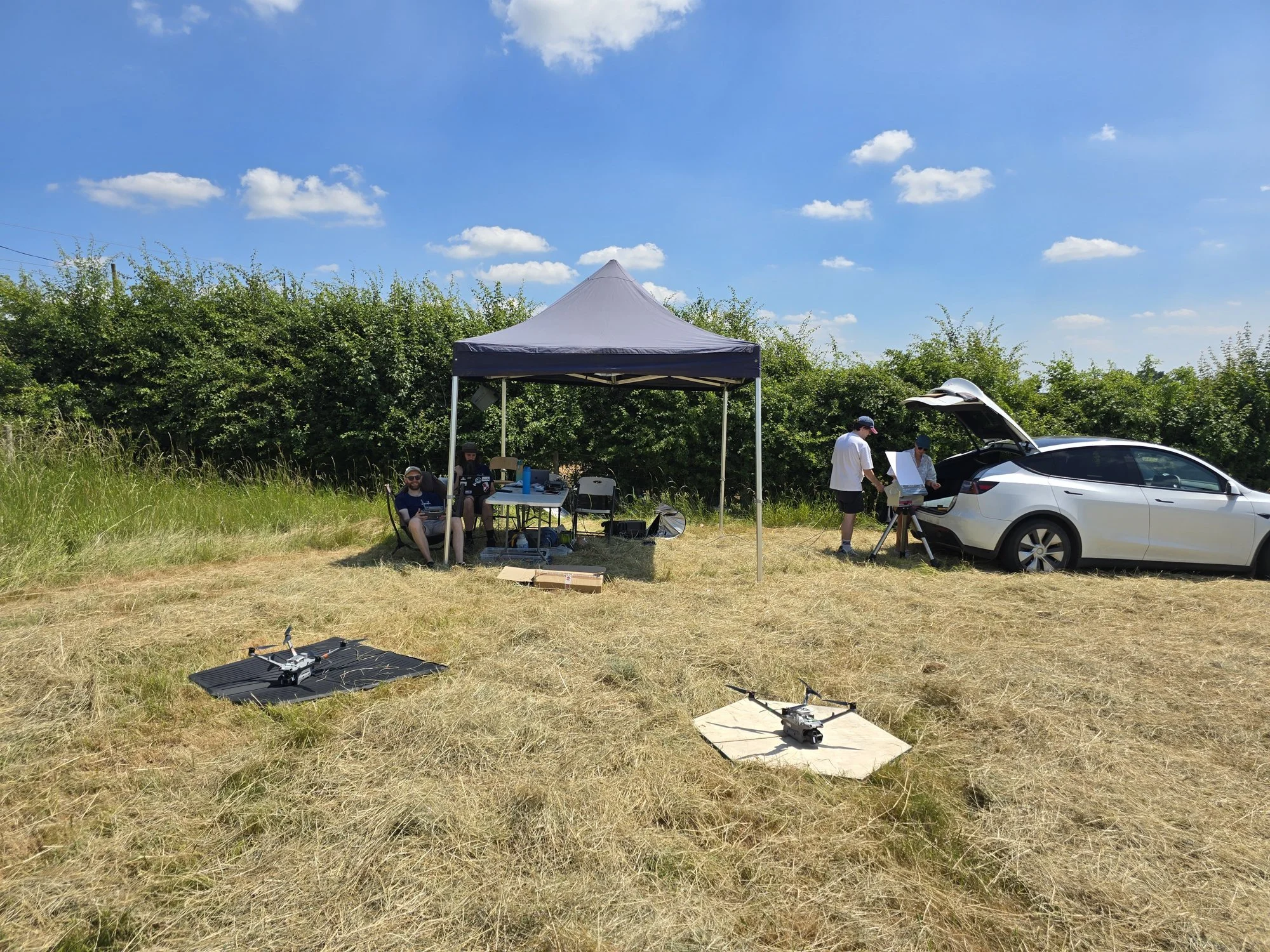
The first end-to-end field test at the Leeds Farm Atmospheric Observatory: two Menapia aircraft on their pads, with the team and ground station. During the June 2026 heatwave.
Case study — ultralight airborne photonics, designed, built and operated in-house for OTTER, a Durham University project under ARIA's Forecasting Tipping Points programme.
Turbulence is everywhere in the atmosphere and almost nowhere in our measurements. It mixes heat and moisture through the air — the same small-scale mixing that climate models have to approximate rather than measure — and it is stubbornly hard to observe directly, especially as a profile from the ground up. OTTER is a way to measure it by reading the atmosphere from beams of laser light sent through it.
A measurement borrowed from the stars
Astronomers have spent decades measuring "optical turbulence" — the same atmospheric churn that makes starlight twinkle and blurs their telescopes. OTTER borrows that idea and points it at the climate. Drones carry laser sources aloft and shine them down onto a ground-based array; from the way the beams scintillate on the way down, turbulence can be profiled along the path — resolved through the boundary layer, rather than as a single bulk number.
The most ambitious part is the customer's. Ollie Farley and his group at Durham are extending the technique to pull out heat flux — the surface-to-atmosphere exchange of heat that drives ice-sheet melt rates and ocean currents — path-resolved, from that same twinkling light. Heat flux has never been measured this way before, and whether it works to the precision the climate needs is an open question. That uncertainty is the point: it's a real frontier, and a measurement idea that, if it lands, could open up far more than this one application.
Our part of the job
OTTER is a project led by Ollie Farley at the Centre for Advanced Instrumentation (CfAI) at Durham University and funded by ARIA's Forecasting Tipping Points programme. The receiver, the technique and the science are Durham's. Menapia's job is the airborne half:
We design and build the laser module the drone carries — light enough to lift, stable and precise enough for real measurement science.
We operate the drones, turning a delicate optical experiment into a repeatable, remotely-operated, automated flying instrument.
Nothing off the shelf comes close to that brief, which is exactly why it's ours.
Ollie and Emily Ronson, mechanical engineering lead. Preparing the kit before heading out to the field.
What we built
So we built it — the whole airborne instrument, in-house:
A fibre-coupled laser system with precision analogue modulation, timed by a GNSS-disciplined MEMS Super-TCXO clock for a clean, accurately-referenced signal.
All of it packaged to a total system mass under 25 grams — light enough that a small multirotor barely notices it is there.
Designed, manufactured and bench-proven by us, then integrated onto the aircraft and flown.
Getting a precision optical instrument down to that weight, and keeping it stable in the air, is the hard, unglamorous engineering that decides whether a measurement like this is possible at all.
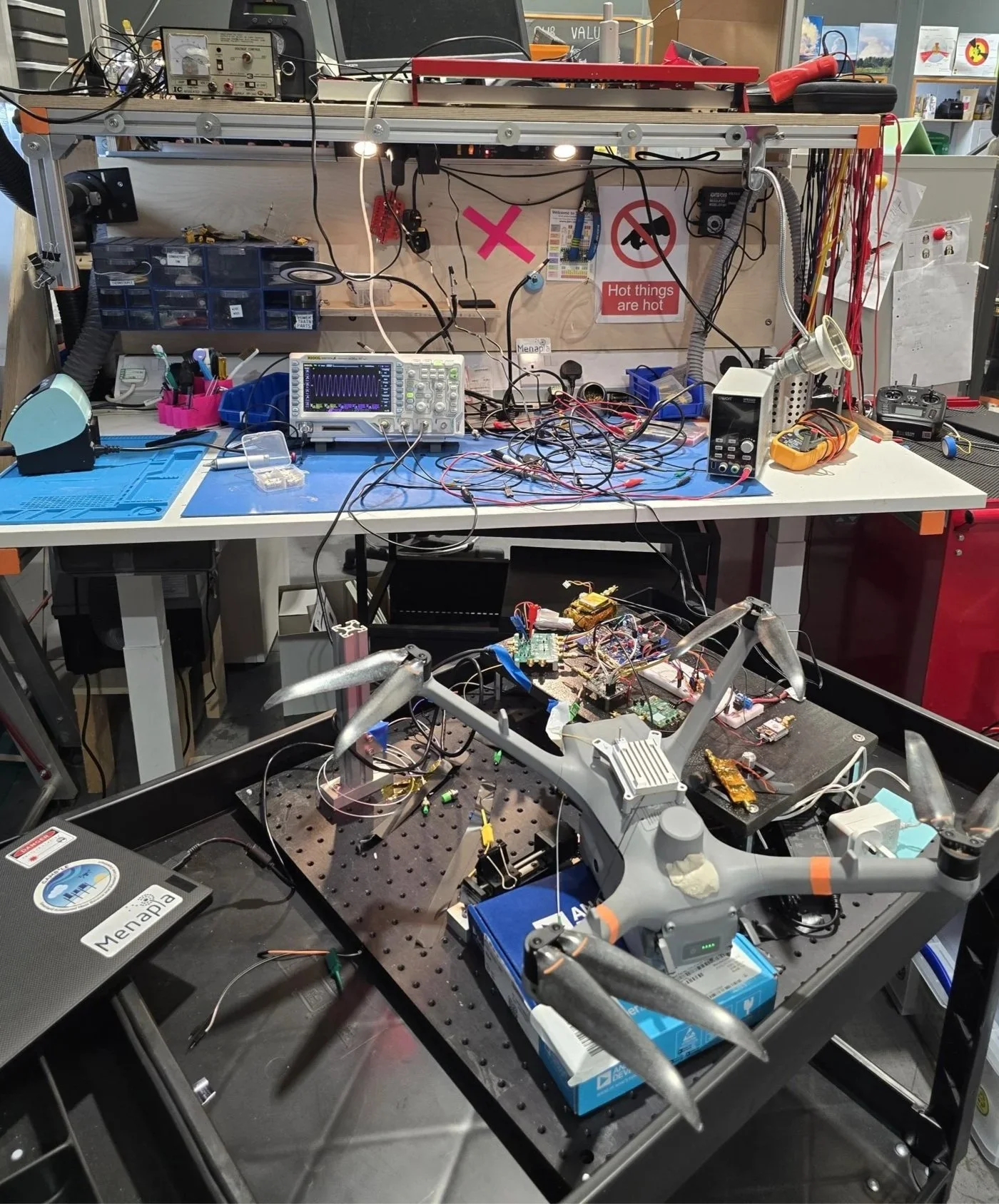
The airborne laser system on the optical bench during integration.
First field test
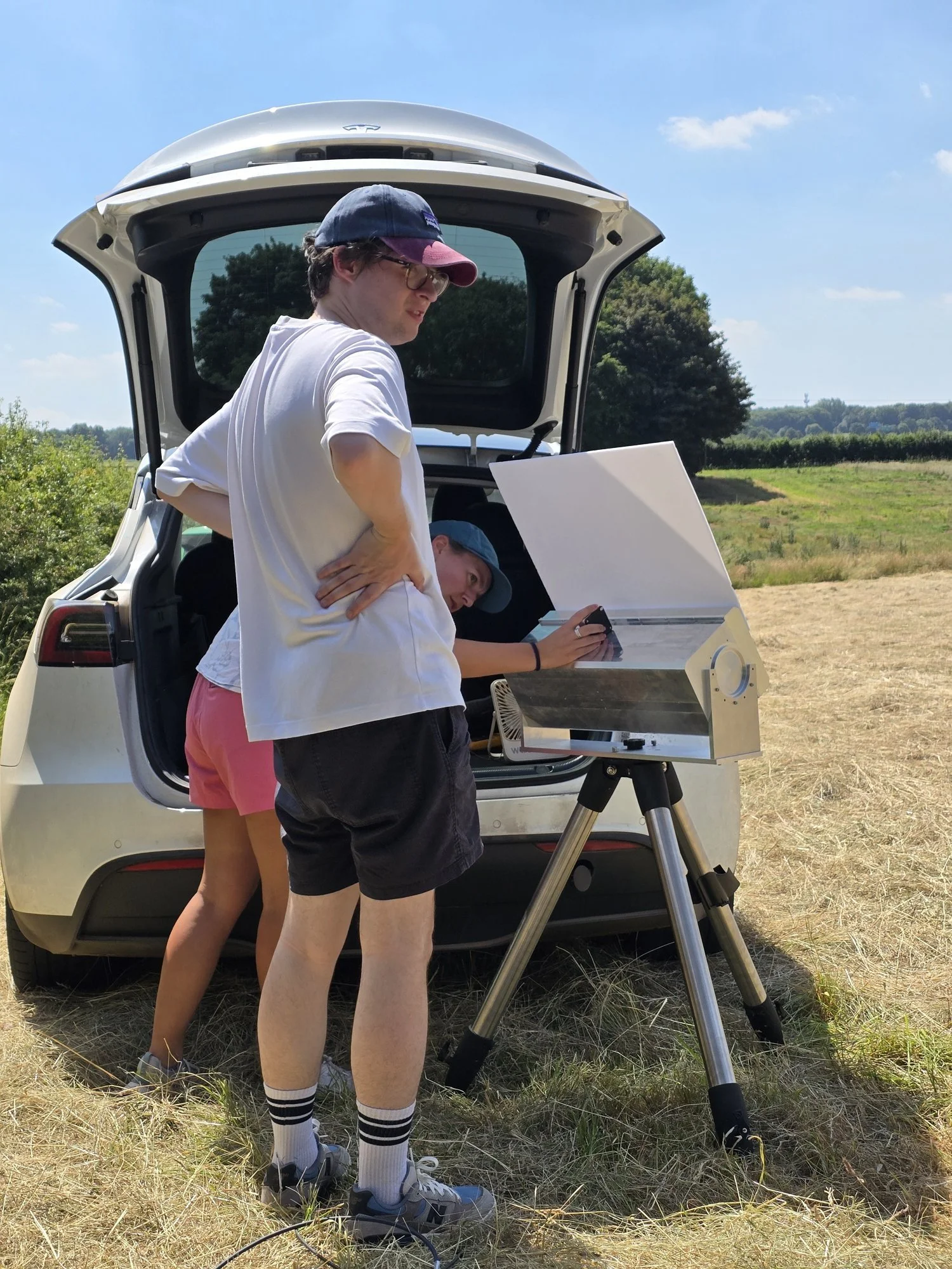
This week we ran the first end-to-end field test at the Leeds Farm Atmospheric Observatory — a new atmospheric research observatory near Leeds — with our drones flying their lasers and putting the beams, air-to-ground, onto Durham's array: the first time the whole chain has worked together in the field. Our thanks to Ryan Neely for access to the site. It was a proper team effort on the ground — Ollie Farley and Emily Ronson from Durham, and John Mooney, Nick Castledine and Michael Woodhouse from Menapia.
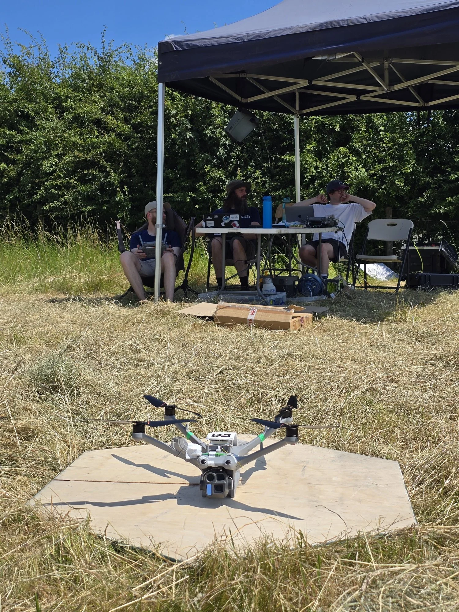
A Menapia aircraft carrying the laser system on the pad at Leeds Farm, with the team and ground station behind.
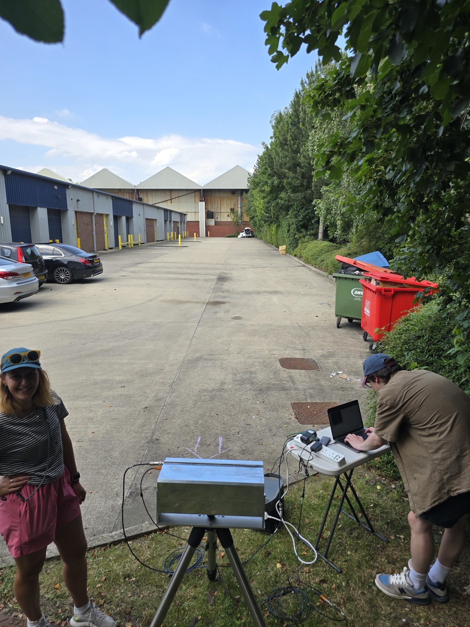
The ground station at the far end of the link.
It's a first field test, not a finished turbulence-and-heat-flux product — there's a long road from here to a profile you'd trust in a climate model. But the awkward part is behind us: bespoke, sub-25-gram laser instruments, built in-house, flying and talking to their receiver.
Why it matters
Very few drone companies design and build their own airborne laser — most bolt a bought instrument onto an airframe and hope. OTTER needed instruments that didn't exist, at a weight nobody sells, flown as a dependable automated system. With them now flying, the next step is Durham's: turning these first beams into the path-resolved turbulence and heat-flux measurements the climate models are missing — and, if the technique proves out, into many more measurements beyond.
Menapia builds and operates the airborne laser system for OTTER, a Durham University (CfAI) project led by Ollie Farley. Field testing took place at the Leeds Farm Atmospheric Observatory, with thanks to Ryan Neely.