
Three instruments, one airframe: hunting ice-nucleating dust over Iceland
Case study — multi-instrument sensor integration for airborne aerosol sampling. DUSTDrone, southern Iceland, October 2024.
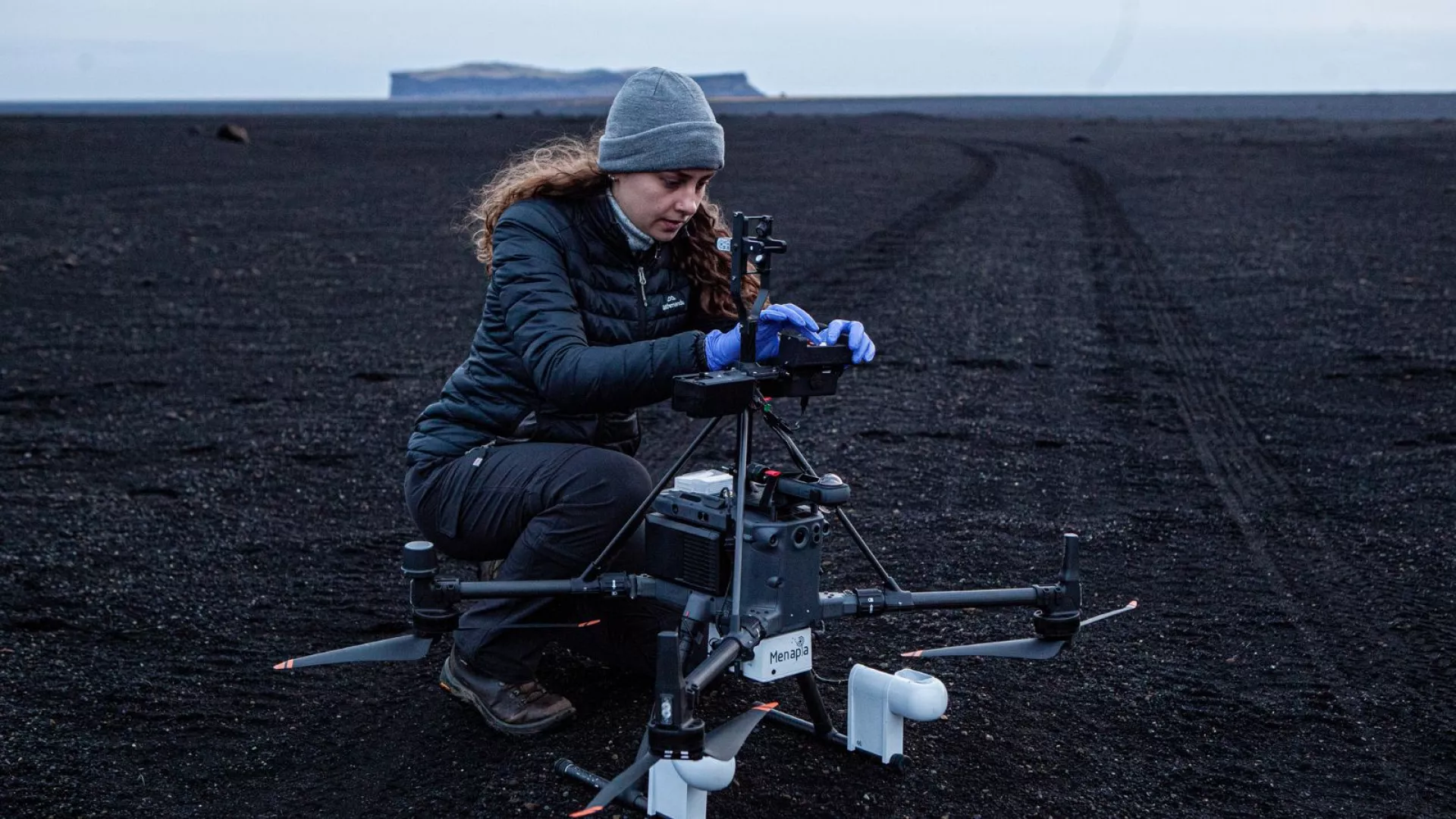
Polly Foster preparing the Electrostatic Dust Precipitation instrument, on black volcanic sand in southern Iceland.
Some of the dust blowing off Iceland's black-sand deserts is unusually good at one thing: making ice form in clouds. These ice-nucleating particles shape how clouds behave 1000’s km away — whether they rain, snow, or simply sit there — yet we know surprisingly little about how they're distributed up through the atmosphere, because sampling them aloft is hard. DUSTDrone set out to do it from a drone.
The challenge
The science needed three very different instruments flying together on one small aircraft, sampling the same patch of air at the same moment:
a fast meteorological stack — temperature, humidity and pressure, with a sonic anemometer for wind;
an optical particle counter, sizing and counting aerosol in real time;
an electrostatic sampler that collects particles onto slides for later ice-nucleation analysis in the lab — and which runs at high voltage.
Two of those — the particle counter and the electrostatic sampler — are University of Hertfordshire instruments; the meteorology is ours. None was designed to fly alongside the others, and the airframe, a DJI Matrice 350, is a closed commercial platform never meant to carry a high-voltage science payload. Making all three share one aircraft, one power system and one clock was the engineering problem.
What we did
We built the integration: a single instrumented aircraft — our "MetSprite-M350" — carrying all three payloads, time-synchronised so every particle count, every sampling window and every weather reading lines up in altitude and time. That meant solving the drone-side power and control for the high-voltage sampler, placing each instrument's inlet where the rotor wash wouldn't bias what it sampled, and proving the whole stack wouldn't upset the aircraft's own flight systems.
Then we flew it — a five-day campaign across southern Iceland in October 2024, working a deliberate altitude ladder up to around 2 km, with blank control flights for clean background subtraction and a planned in-cloud pass where aerosol turns to droplet.
What it proves
As far as we know, no one had flown this combination — real-time sizing, particle collection and co-registered meteorology — on a single small drone before. We handed the customer a coherent, altitude-resolved dataset to take into the lab.
This is what integration means in practice: not bolting a sensor onto a drone, but making several awkward, third-party instruments work as one airborne measurement system — and then operating it somewhere remote and cold. The science of what that Icelandic dust does to ice formation belongs to the research team. The flying instrument that went and collected it is ours.
DUSTDrone was flown for a University of Leeds-led research team, with aerosol instruments from the University of Hertfordshire. [CONFIRM which partners/researchers to name and the framing before publish.]