
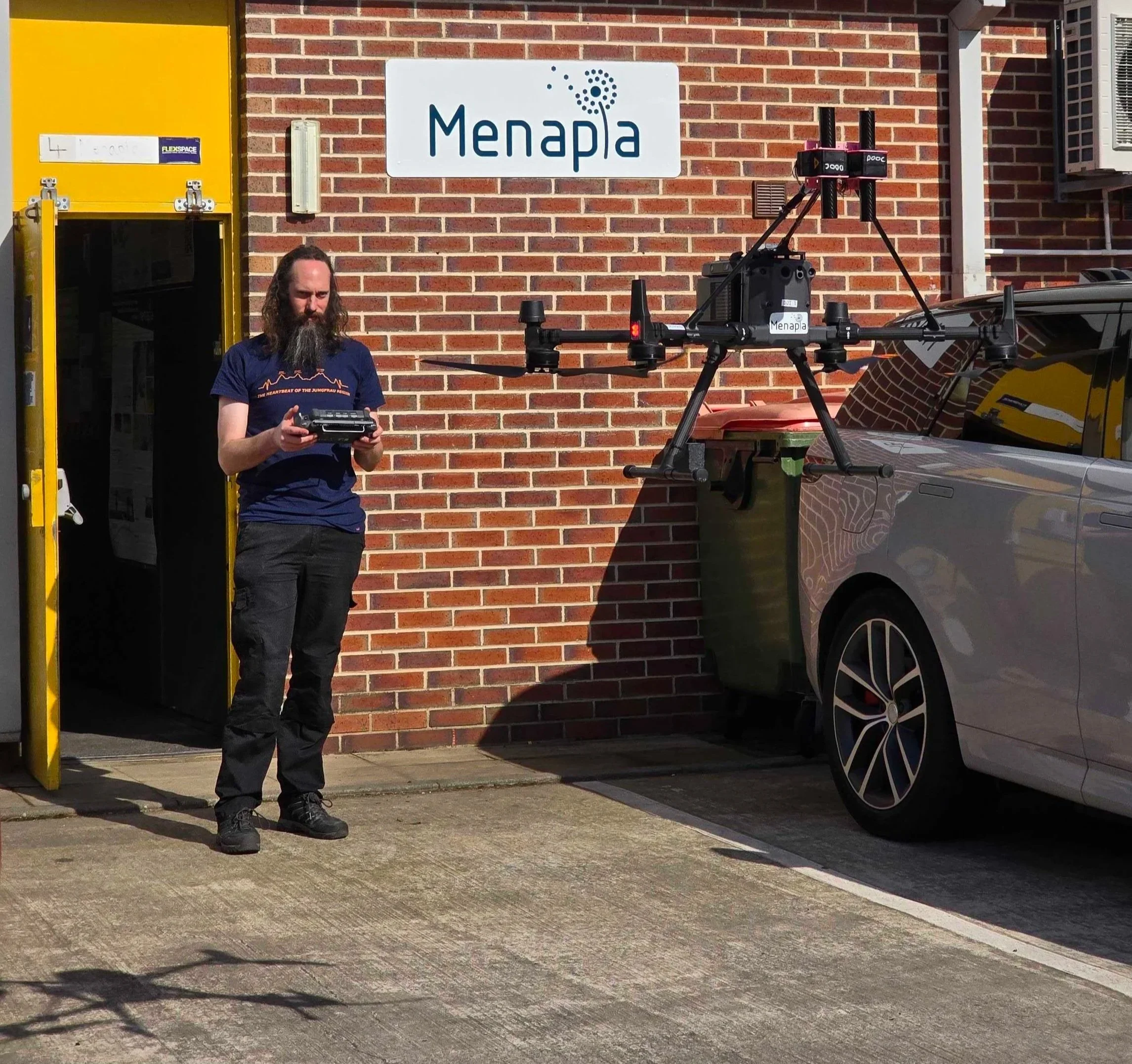
Into the clouds: DOOC and our new airspace at Snaisholme
With Dr Declan Finney (UKRI Future Leaders Fellow, Leeds), Menapia’s DOOC project is measuring clouds from drones — and this week we began flying in our new EGD493 airspace at Snaisholme under CAA authorisation to 1.5 km.

742 flights, one Icelandic field, no pilot on site
In an extended Iceland trial, a Menapia drone flew 742 automated profiles from a weatherproof dock — launching, profiling, and swapping its own battery with no pilot on site, more than half of the flights reaching above the boundary layer.

Menapia in ARIA's Forecasting Tipping Points programme
Menapia is contributing drone-based atmospheric measurement to ARIA’s Forecasting Tipping Points programme — including OTTER (turbulence-sensing lasers) and GAMB2LE (flying in the cold). Here’s the why.
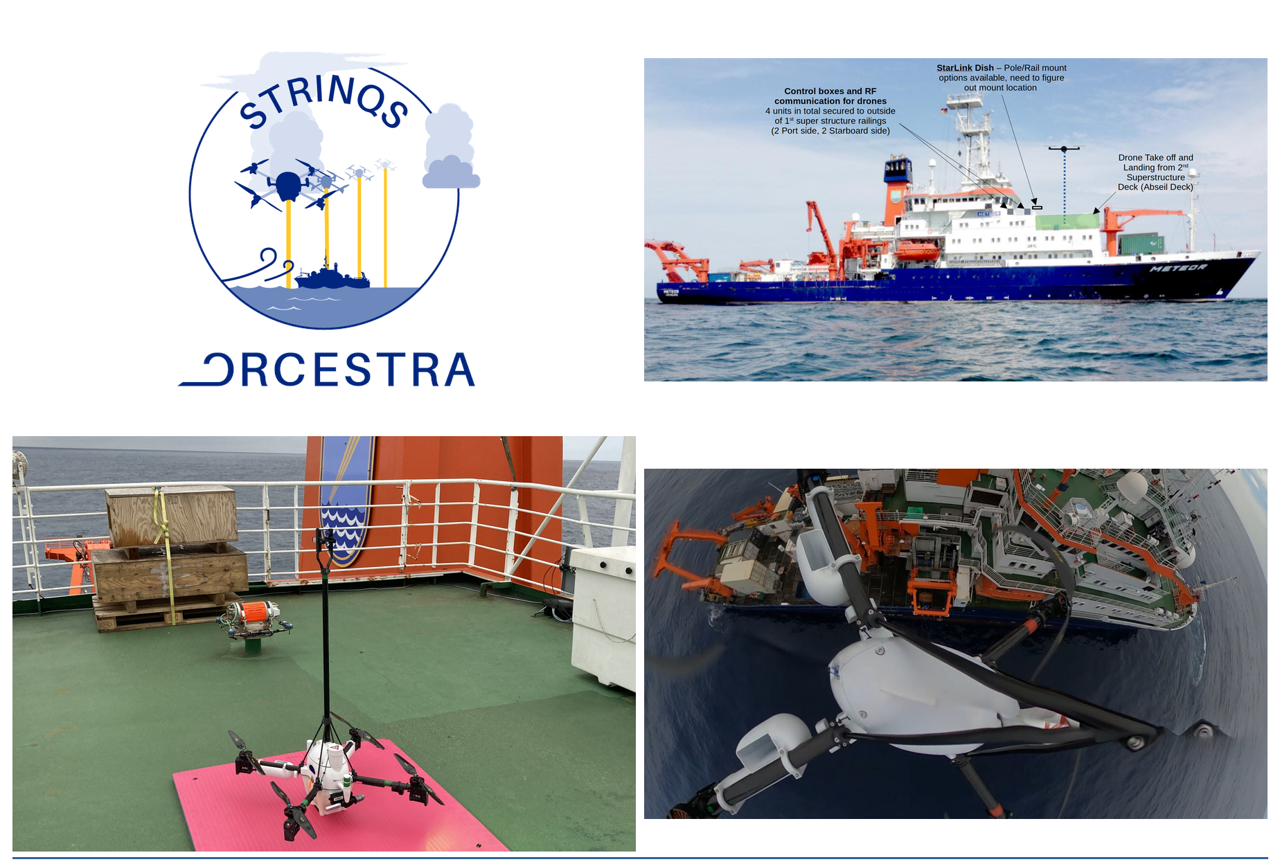
Flying off the back of a ship: STRINQS in the tropical Atlantic
Four Menapia quadcopters went to sea in 2024, flying simultaneous, coordinated atmospheric profiles from a research vessel in the mid-Atlantic for TU Delft’s STRINQS campaign — including the first three-drone coordinated hexagon we know of from a moving ship.